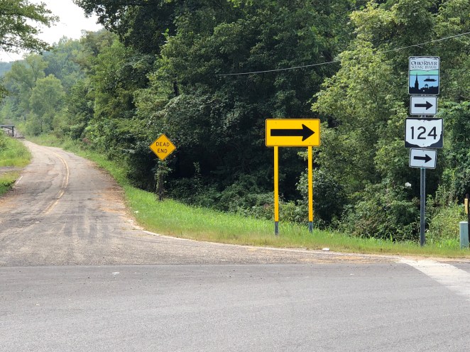
 My goal in riding today was to make it the 60 miles/100 kilometers or so to Krodel Park Campground in Point Pleasant, West Virginia. I expected a hilly ramble on a very minor road, Ohio State Route 124, right up along the bank of the river to the town of Pomeroy, then a ride across a bridge to West Virginia with the last 15 miles/25 kilometers or so completed in that state.

I couldn’t have been more wrong.
There’d been at least one hard rain shower overnight, but I had set my tent up on the asphalt parking area of the campsite which did a good job draining any water away from it.

The campsite’s grass, leaves and picnic table were very wet though, And I felt like, despite all my efforts, my cycling gear and clothing were just becoming more and more damp and sodden as the days of the trip continued on. I looked forward to addressing this on the rest/slack day I have planned for tomorrow in Point Pleasant.
I stopped briefly at the campground office, which was the only place in the park where wi-fi was available- there was no cell signal here- checked in, got my daily weather report and filled up with water.
I expected a very humid day; at least that was what the forecast said.
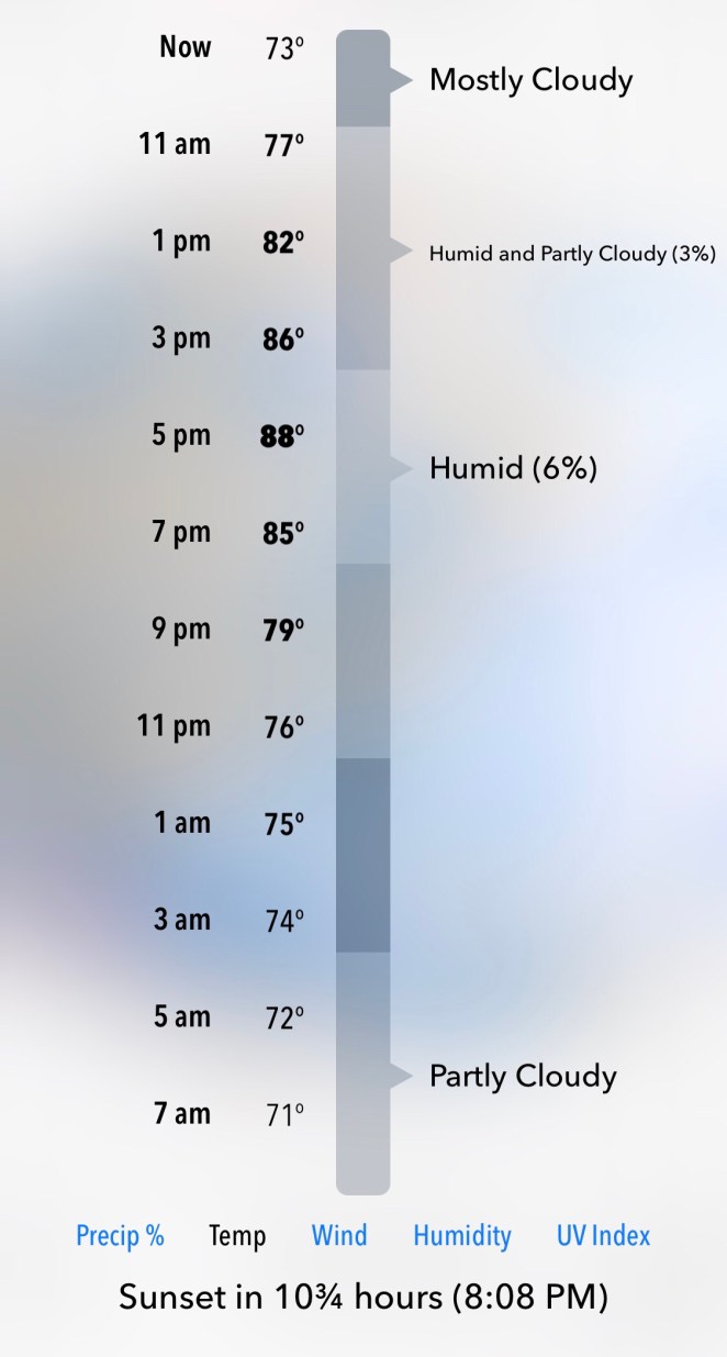
At least, I thought, there was little chance of rain. Yeah, right. I’ve heard that before.
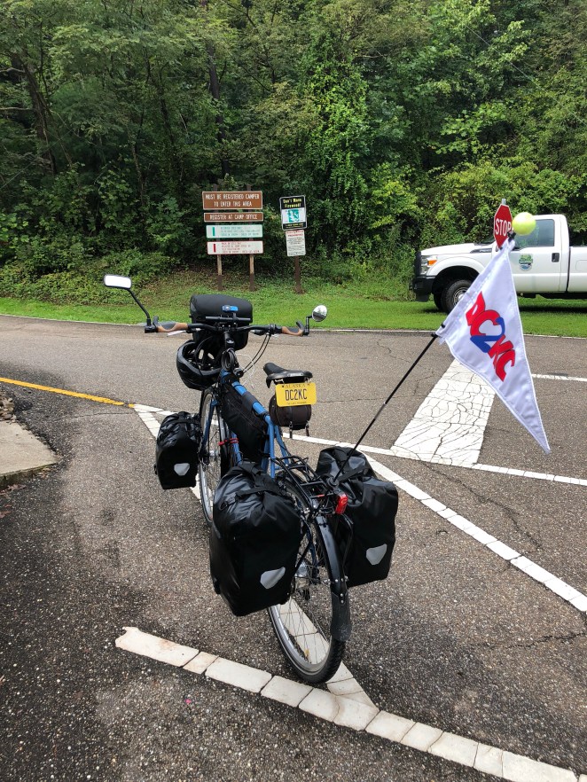
In any event, I was soon out the road past the entrance sign

and on my way.
I noticed right away a pretty significant difference between this and previous days riding along the river. While the land further north had been, away from the cities and factory sites, rural agricultural in nature, that basically translated out into overgrown weedy fields and some livestock here and there. Now I was seeing row crops, and lots of them.
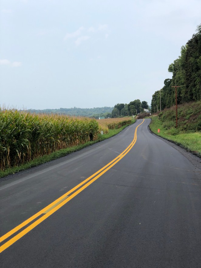
I don’t know if that corn was as high as an elephant’s eye, but it did look pretty late in the season. Yesterday’s bluffs and cliffs that State Route 124 seemed to seek out just so it could go pointlessly up and down had receded to about a mile away from the river- still visible but not near so much a threat. I passed through a quaintly named hamlet

but didn’t see any Hobbits.
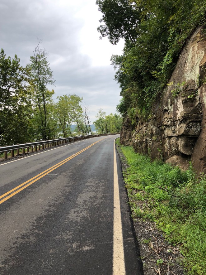
The hills did make a return every so often- Seemingly more to remind me that they were still there then anything else- but I found that they afforded me some excellent views of the river.
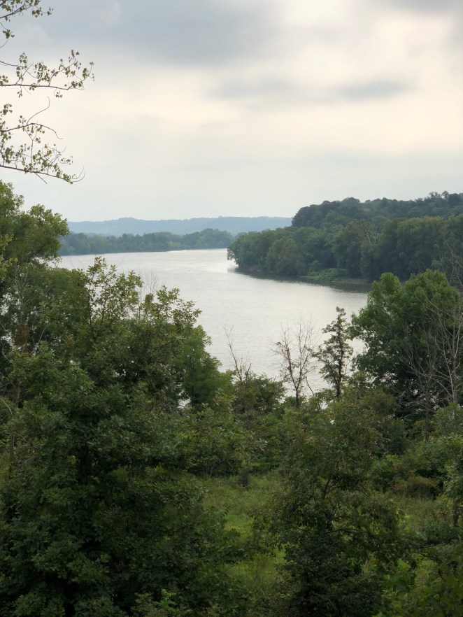
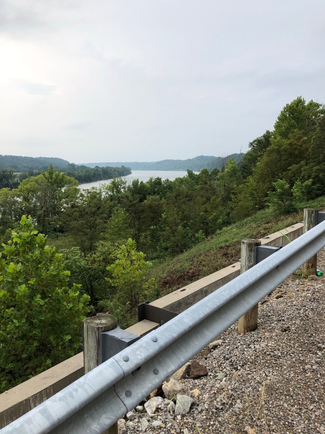
So I didn’t complain about them too much. And what would’ve been the point? I would’ve been the only one listening.
The cliffs reappeared here and there, too.
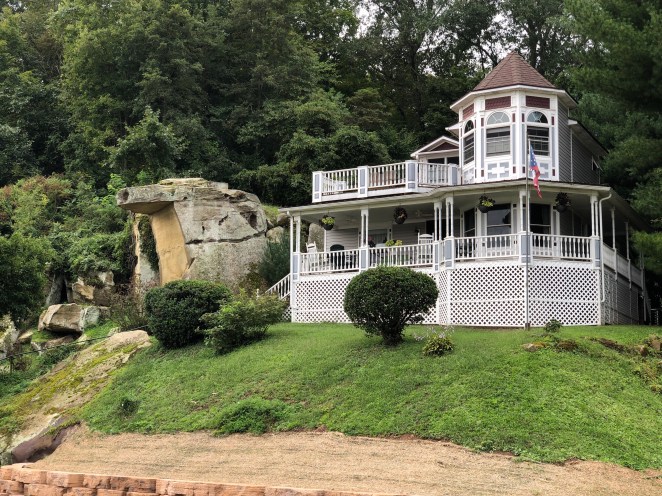
Large rocks took sometimes whimsical forms.
I passed a Civil War battlefield in a tiny park and wondered, except for a very few scholars and the people who live a few miles/kilometers in either direction, who else besides me had ever heard of it.

“Buffington Island” just doesn’t have that great battle ring to it like, say, “Antietam” or “First Manassas.”
And then I got hit with the first big thing of the day.
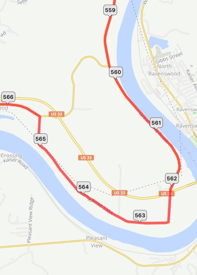
My planned route took me around a big oxbow bend in the Ohio just west of Ravenswood, West Virginia. There was no indication on any of the mapping programs that this would be an issue. Unfortunately, this was what I ran into at the road junction right before the “560” mile marker on the above map.
A nice lady in a passing car headed in the direction I had just come from, stopped, and rolled down her window. She asked me if I was lost and I said, “no, just confused.” She told me that the road along the river hadn’t been open for years. “No way to get through?” I asked. She told me the road was blocked before it reached US Route 33 and the bridge over into West Virginia. I thanked her, turned the corner, and headed up the relatively gentle hill.
The junction with Route 33 was at the top of the ridge which, as I’ve noted, wasn’t really so bad a climb. That’s where I got my second shock.
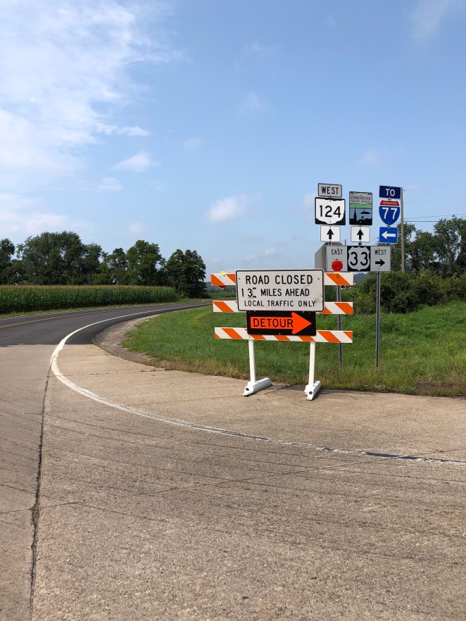
The guy in the “CAT” baseball cap behind the counter of the convenient store at this intersection told me that there was a landslide that blocked the road that created the detour. “No way to get through it?” I asked. The guy said nope, and that was it. Here is what I was looking at.

The convenient store is located just about at the top right corner of the “565” mile marker. The landslide blocked the road at the “578” mile marker. There was no way that I was going to ride 13 miles/21 kilometers, as scenic as it might be, on the one in maybe 1,000 chance that I could somehow be able to get my bike and myself around the landslide. The prospect of just having to turn around and ride the 13 miles back was just too grim.
So I proceeded to lop another big chunk off of my planned route today. I didn’t like doing that, and I was a bit upset about the state of Ohio seeming to be indifferent to properly maintaining this incredibly scenic road, but what could I do except head up route 33 into the hills miles from the river?
To be fair, the detour worked out pretty well. Route 33 had apparently been completely reconstructed to modern standards in this area and, while I was continuously climbing, The grade was probably around 4%. It seemed like it really didn’t take any time at all to reach the minor road marked on the above map through the hamlet of Dorcas that headed down to the riverside village of Racine at the “581” mile marker.

This appeared to be the beating heart of rural Ohio.

Because I had been high up on a ridge on Route 33 the road down to Racine was in fact down- downhill more or less all the way. It was really a sort of pleasant ride, just not the ride that I had planned to make. I picked up Route 124 as I passed through Racine.

Just like it never happened.
I figured I had lost in total somewhere just over 10 miles/16 km or so of the route I had planned for today. Oh well. Can’t really lose what you never had to begin with. I pedaled on.

It seemed like the river had been waiting for me.
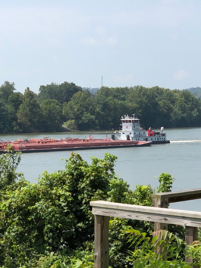
I saw more barge traffic today then I had seen on the Ohio to the north.

It was nothing like the busy Mississippi traffic that I had seen so much of the year before, but it was always interesting to watch.
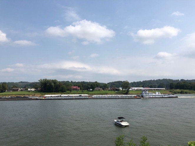
The Ohio River looks to me to be much more narrow and twisty then does the Mississippi. I imagine that being a boat driver pushing a big string of heavily loaded barges must be a fairly skilled occupation.
In a couple of miles/kilometers, I was in the Pomeroy/Middleport area just short of crossing the river over to the West Virginia side for the last stretch.
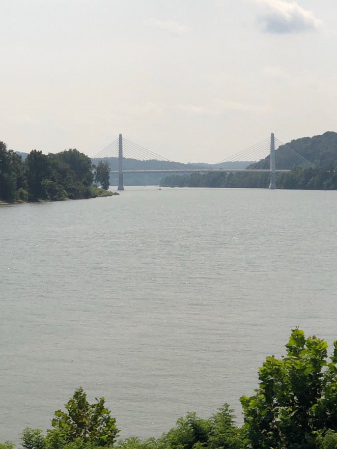
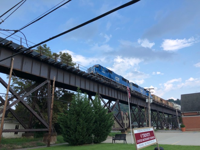
The crossing would be made on what I’ve come to conclude is my least favorite style of big road bridge- a cable-stayed span. I think these bridges, which are all they seem to be building the stage, are America’s bridge design version of Stalinist architecture.

They don’t gracefully arch over the water so much as loom above it.
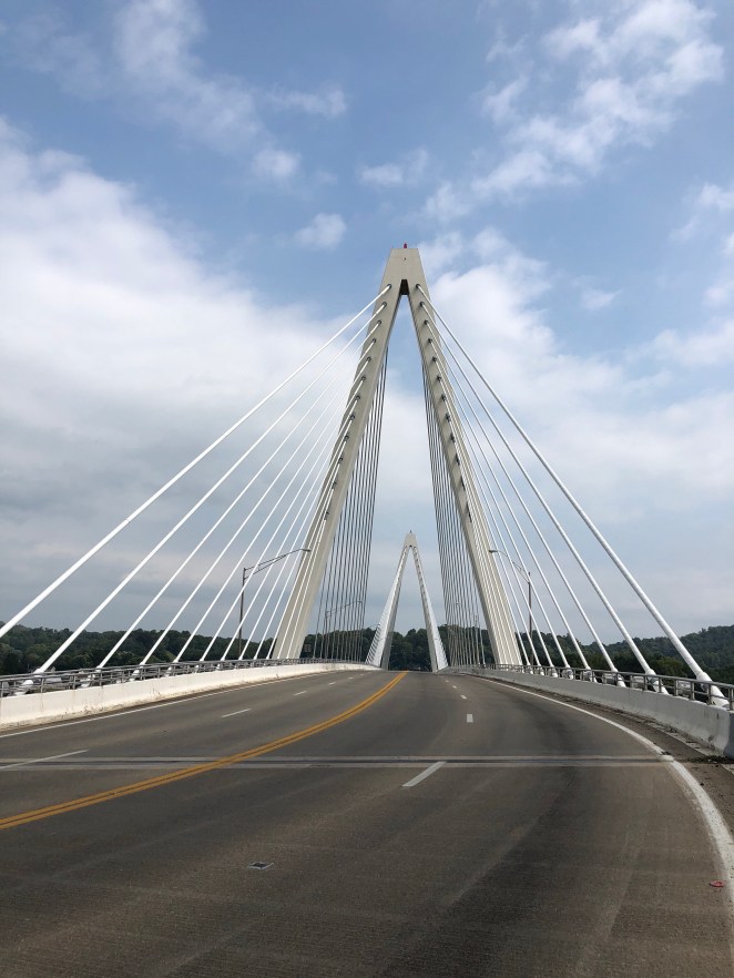
Give me a beautiful old steel truss bridge any day, but this is just one more thing I guess I really can’t do anything about. One more “Oh well” in a day of oh wells, I guess.
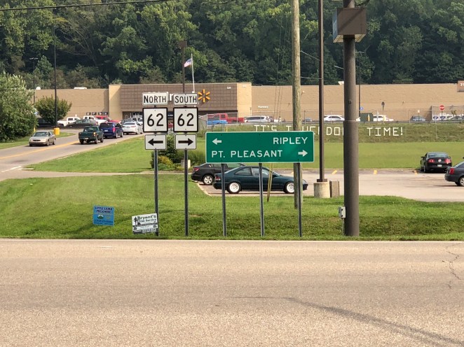
On the West Virginia side I picked up State Route 62 and headed south towards Point Pleasant.
Route 62 was a nice ride: a few low hills and not really any views of the river, but very pretty countryside.

The site of big industrial facilities through the trees reminded me that the river was never really very far away.
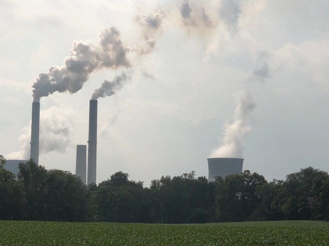
I think I’ve seen more active smokestacks in the past three days of this ride than I’ve seen in the last 40 years prior. There were way more along this stretch of the Ohio than there were on my ride last year down “Chemical Alley” along the Mississippi between Baton Rouge and New Orleans in Louisiana. Another thing that was also noteworthy about industry along the Ohio is how rarely any of it smelled like, well… industry. I’m not saying that there were a couple of stinkers here in there, but they were really few and far between. I’m sure that has a lot to do with all of the environmental regulation and controls put in place over the past 50 years. I’m not a big government guy, but I think the way that the United States has dealt with its environmental challenges is really pretty magnificent on the whole. I’m sure that what we’ve done has led to a lot of factory and plant closures over the years as a result, but the upside to that is the way is cleared for new facilities employing modern technologies. Call me naïve, but I think we’ll figure it out, and have the benefit of living in a much cleaner and healthier country to go along with it.

Finally, after having survived all the detours and other challenges of the day, I arrived in Point Pleasant.

I took a quick turn through the downtown looking for what turned out to be either nonexistent or a very hard to find bike path along the river, then turned inland and headed for Krodel Park, where I planned to camp for the night.
There was blue sky off in one direction but to the west it had become very dark and I was hearing a more less constant rumbling of thunder. I arrived at the park and, bluntly put, didn’t care for what I saw. I’ll write about that in my next blog post [link] but pretty much knew within 10 minutes of my arrival that I was not going to spend the night at the park. I wasn’t leaving right away, though. I just had time from feeling the first drops to make it under a shelter and then the skies opened up for about 20 minutes.

It just poured. While I was under the shelter waiting things out I used Google to go over my lodging options. Camping anywhere was out of the question- not because of the rain but simply because there were no other campgrounds for way more miles down the river than there would be time for before it got dark.
So a motel it was. The cheaper the better. I have standards, but they are pretty low. A clean room and clean sheets are all that it takes to turn my head. I found a Motel 8 in Kanauga, Ohio, just across the river. I sighed, remembering the days when the “8” part of the name meant eight dollars a night, and made a reservation.
I rolled out of Krodel Park without any regrets. Probably, staying there would’ve been just fine, and the worst that would’ve happened was that I would’ve gotten wet, well soaked actually, in the huge thunder and lightning storms that we had later on that evening. But going with my gut has taken me a long way as a bicycle tourist over the last couple of years. If I start disregarding that what do I have left to fall back on?
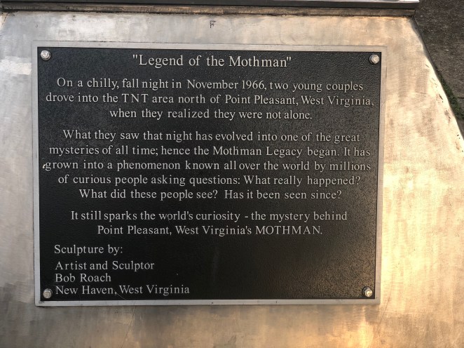
I wasn’t going to leave Point Pleasant without seeing the Mothman statue. I vaguely recollect a movie with that name in the title 10 or 15 years ago. Other than that I was blissfully ignorant of things Mothman. But at least ten of my friends were urging me, no… almost ordering me to stop and see the statue.

So there you are, folks.
I bet the businesses along that street just love having that out front.
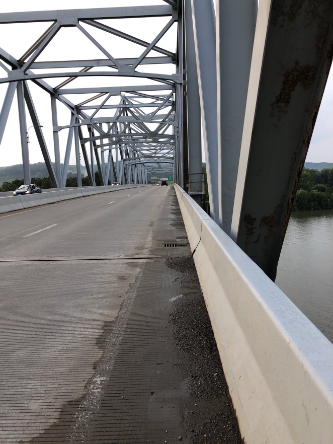
I did enjoy riding over the bridge that spanned the Kanawha River.
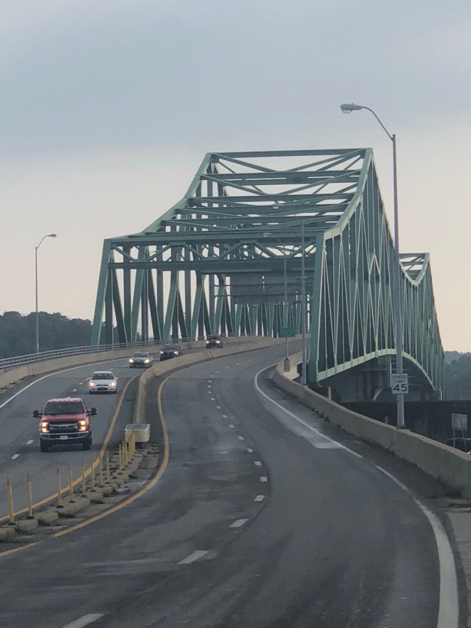
Now that’s a bridge! It was followed by the Silver Memorial Bridge back over the Ohio.
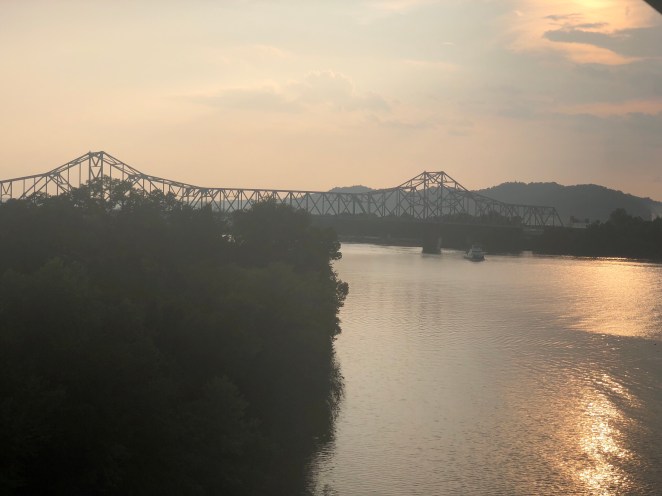
I won’t dwell on it here, but this bridge replaced an older bridge- the Silver Bridge- that had fallen into the Ohio in the 60s, claiming almost 50 lives. That disaster led to the creation of many of the modern bridge inspection rules we have in place today. It was a horrible thing to have happen, but with the exception of the Interstate 35W bridge collapse in Minneapolis about a decade ago we have been remarkably free of bridge failures for a nation with so many of them. We take that safety for granted, but should never let it cause us to become complacent.
The Motel 8 was at the end of the ramp off the bridge. A Golden Corral was two doors down. The thunder and lightning storms had not arrived yet, but they could be heard booming and seen flashing in the distance. Life was good.
