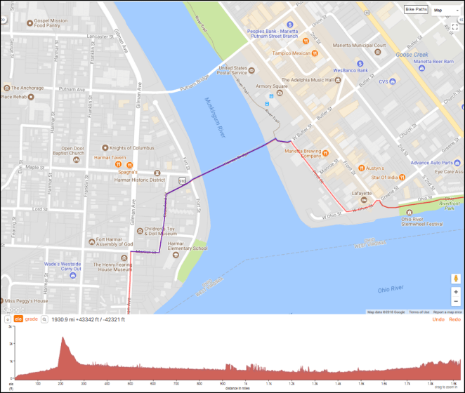
 As I’ve previously noted I’ll spend six riding days and the smidgen of a seventh on the C&O Canal Towpath from its east to its west end at Cumberland, Maryland. Here’s the entire towpath

and here’s each day’s ride:
Day 1 – Thursday, August 9, 2018
Washington, D.C. (Mile 0) to Chisel Branch Hiker/Biker Campground (Mile 30.5)
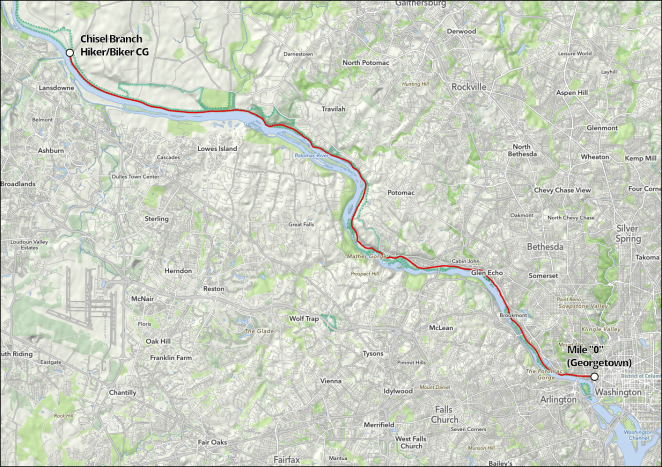
The Canal and Towpath begin in the Georgetown area of D.C. Several sources I have looked at say that finding the actual start of the Canal is a bit “tricky,” but I’ve found the the Great Allegheny Press’s “Trailguide” [link] to be a great resource in that regard. On page 96 of the 14th Edition it notes:
From the C&O Visitor Center near Lock 3, walk or bike on the brick sidewalk with the canal on your right. After 29th Street the brick path ends at Rock Creek Parkway Trail. Turn right onto the asphalt sidewalk. Cross the entrance ramp of the Whitehurst Freeway; pass underneath K Street; then cross the exit ramp. At the Thompson Boat Center sign, turn right into the parking lot. Cross Rock Creek Bridge. Bear left around the Boat Center and pass between the boat house and river. Pass around a stockade fence. Cross over the inlet lock footbridge to reach the granite monument marking Mile 0.
Sheesh! I’ll have to pack a lunch just to get to the start of the ride!
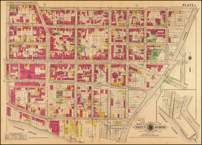
The Trailguide also provides a map, which would appear to me to make everything pretty straightforward.

© 2018 Great Allegheny Press, fair use asserted
I want to make sure everyone understands that there’s no intent to leech off all the hard work that the Great Allegheny Press folks have put into the Trailguide. In fact, if you plan to ride the Towpath or GAP, you really need to buy a copy buy a copy [link]. In addition to providing really useful information like the above, the purchase of the Trailguide as the proceeds are reinvested in the Towpath and GAP trail.
Projects like helping with rockslides at Paw Paw Tunnel and near Sutersville, PA, signage, rehabbing the Pinkerton Tunnel to eliminate a detour, help with resurfacing the towpath near Hancock, a few bike repair stations, and a blueprint for improving the towpath were funded with proceeds from this publication.
Trailguide, 14th Edition, p. 9
Back to Georgetown.
I have two days to ride around Washington, D.C. and Northern Virginia- the 7th and the 8th– before I start the ride. One thing I plan to do is ride the Towpath in Georgetown so that I can take the several hundred photos that I know I will want to take of this incredibly historic and scenic area. Bonus: I’ll scout out the start of the Towpath so I can get an immediate start on the 9th.
Once out of Georgetown I’ll pass a number of “must see” scenic and historic sites. These include
- The Potomac Gorge (Towpath Mile 2)
- Maryland State Line (Towpath Mile 4.7)
- Cabin John Bridge (Towpath Mile 7.7)
- Carderock area (Towpath Mile 10.8)
- Great Falls area and Overlook (Towpath Mile 14)
- Seneca Creek Aqueduct (Towpath Mile 22.8)
I’ll say a few words here about the Bike Washington C&O Canal Towpath web pages [link]. While the Trailguide provides an excellent overview of the Towpath’s route, the Bike Washington site is where you should then go for detail. It provides mile by mile info in a handy form [link].

For iPhone users like myself a lot of Bike Washington’s info is available on an app [link], so it can be easily accessible on a ride. A huge amount of work has gone into putting all this together and kudos are well deserved by all involved.
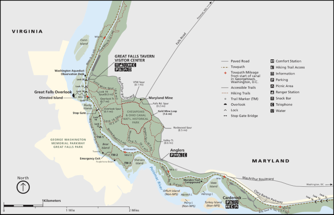
This first day on the Towpath includes a C&O Canal and Towpath major scenic highlight: the Great Falls of the Potomac. Starting at around Towpath Mile 12, the Great Falls area presents incredible natural beauty and a stunning illustration of the sort of challenges and obstacles the builders of the C&O Canal faced almost 200 years ago. The National Park Service has created a nice detail map of the Towpath from Mile 0 to the Great Falls area.
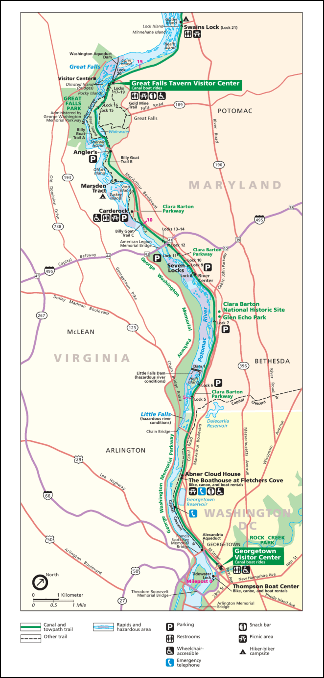
It is a shame maps at this level of detail aren’t available for the entire Towpath. The NPS also has a very detailed map of the Great Falls area itself. While the map is mainly for the benefit of hikers, it gives an excellent sense of the things that there are to stop and see in this amazing place.
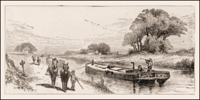
I was briefly confused by the use of the term “aqueducts” in connection with the Canal and Towpath. I had a concept of an aqueduct as a channel, often depicted up on a bridge, to carry water into an urban area or an agricultural zone.
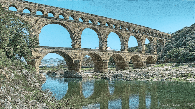
There are eleven aqueducts along the route of the C&O Canal and Towpath. I’ll see the first of these today at Mile 22.8 across Seneca Creek. These aqueducts carry the Canal and Towpath over the various small streams that flow into the Potomac. They are beautiful works of early 19th century civil engineering and the Park Service has done an incredible job restoring and preserving them.
I am assuming that today’s ride will take all day long due to the numerous stops I will be making to take photos and just to see the sights. Once outside of Georgetown there are no cities or towns that I will pass through before arriving at Chisel Branch Hiker/Biker Campground. I will plan to grab lunch at the Great Falls Snack Bar about halfway through the ride and will carry a cold supper in my panniers.
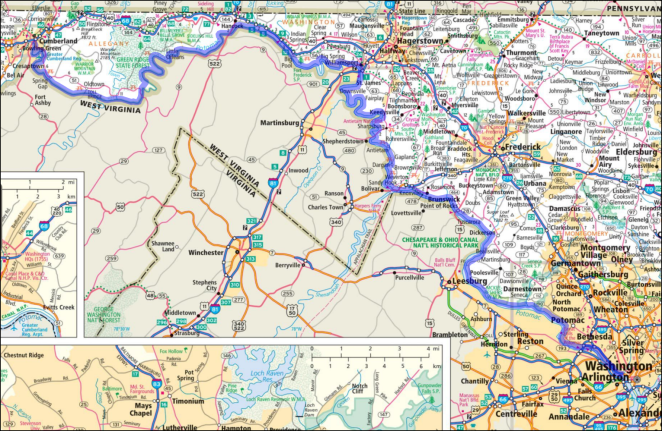
Day 2 – Friday, August 10, 2018
Chisel Branch Hiker/Biker Campground (Mile 30.5) to Teahorse Hostel (Mile 60.4 + 1.3 miles off route)
On the second day of my ride up the Towpath I’ll pedal 31.4 miles/50.5 kilometers from the Chisel Branch Hiker/Biker Campground to the historic city of Harpers Ferry, West Virginia. During the day I’ll pass through a gap in the first outlier ridge of the Appalachian Mountains at the community of Point of Rocks, Virginia, deal with a detour around a section of the Towpath that is closed due to a culvert washing out, and enter West Virgina, a state of which I’ll see much more, in a couple of weeks, for the first time on the ride. I may also decide to do a “there and back” crossing of the Potomac on White’s Ferry, which operates at a location from which there has been continuous ferry service since 1817.
- White’s Ferry (Towpath Mile 31.7)
- Monocacy Aqueduct (Towpath Mile 42.1)
- Point of Rocks, Virginia (Towpath Mile 48.2)
- Catoctin Creek Aqueduct (Towpath Mile 51.5)
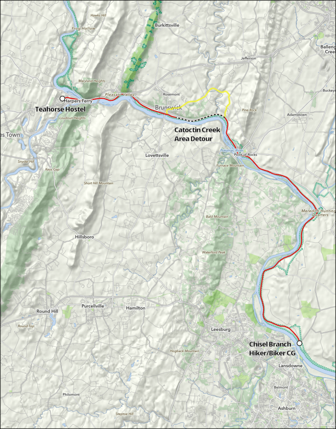
- Brunswick, Virginia (Towpath Mile 55)
It looks like I’ll have to deal with a detour around a place on the towpath where a culvert has washed out and not yet been repaired near the Catoctin Creek Aqueduct.
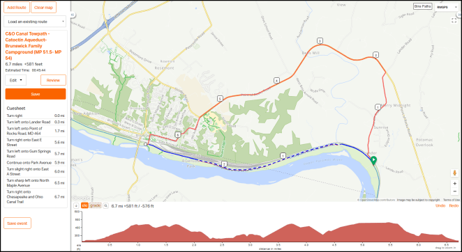
There’s about 6.7 miles of local roads to navigate in making the detour. Reportedly they are hilly and narrow, and the Park Service tries to discourage riding on them and recommends arranging a shuttle through the area instead.
There is no detour in place at this time due to unsafe conditions on adjacent roadways.
Well, clearly there is a detour. And it’s a free country and those are public roads. I have a hard time imagining that they present a worse challenge than, say, the miles of mountainous narrow high traffic highways I tour on up here in Alaska. A shuttle may be fine for some, but I think I’ll take a pass on it and brave the “no detour” detour.
Or, maybe not. A friend who will remain anonymous has let me know that he rode up to the washed out culvert, unpacked his bike, carried it across the ankle-deep stream, went back and made a second trip with his panniers, reloaded the bike and was on his way. Sounds like a plan to me. We’ll see.
It looks like Point of Rocks will be a nice place to stop for lunch. I can get dinner in either Brunswick or after I arrive in Harpers Ferry. Probably I’ll just stop at a store and get hard sausage and a piece of cheese. Hey! I like sausage and cheese, the perfect cycling dinner.

Day 3 – Saturday, August 11, 2018
Harpers Ferry (Rest/Slack Day)
Harpers Ferry!
Well, that is what comes to my mind, anyway.
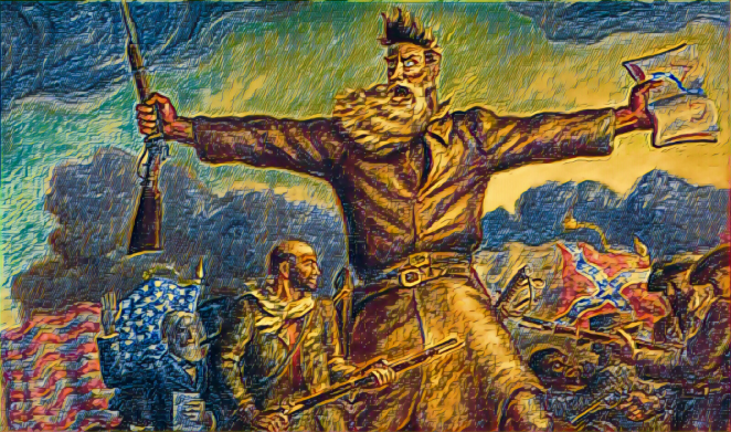
John Brown’s 1859 raid on the Harpers Ferry arsenal is just a small piece of the history of this gem-like little town, now largely historically preserved by the National Park Service. It is a major Civil War location as well. Here’s a map of Harpers Ferry and the surrounding area that will give you an idea of the size of the Park Service’s holdings in the area.
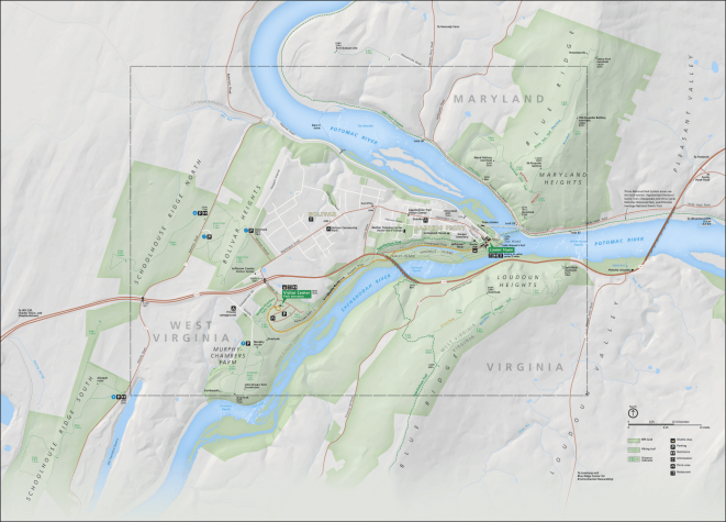
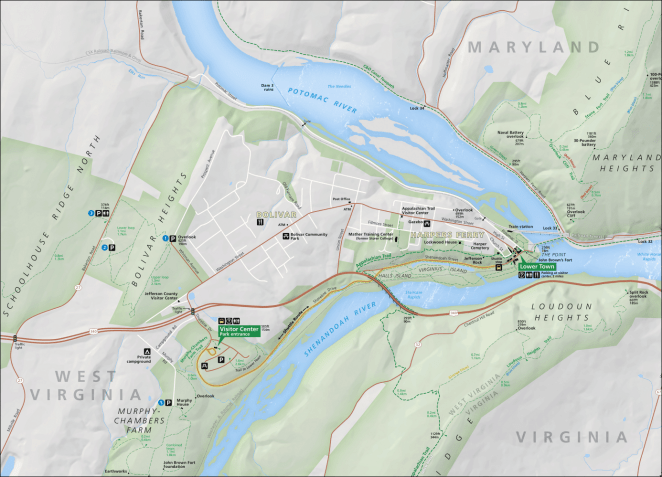
Due to the large size of that map I have outlined the central area of Harpers Ferry appearing in the map below with a gray dashed line.
Here’s a National Park Service isometric map of the historic area downtown and immediate environs.
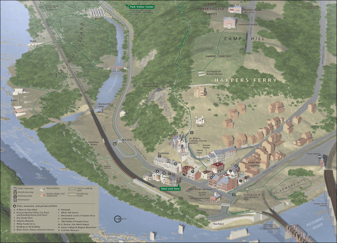
Harpers Ferry is located at the confluence of the Shenandoah and Potomac Rivers.
It is here that Virginia gives way to its poor relation sibling West Virginia; a result of the division between slave and free factions during the Civil War. Beyond its historic significance, the city is a major milestone along the 2,178 mile/3,505.2 kilometer Appalachian Trail in being located on the trail’s approximate midpoint and in being the home of the Appalachian Trail Conservancy and its Visitor Center.
I’m taking my first rest/slack day of the trip here not so much because I think I’ll need on, but because I have just always wanted to see the place. A day will give me enough time to walk around the historic district, visit the ATC Visitor Center (I’m a frustrated wannabe through-hiker) and just hang out in general. I have reservations for two nights at the Teahorse Hostel, which reportedly serves a nice breakfast. I’ll have secure storage for my bike and gear there, so I won’t be worried about being away from it for a while while I look around. I’m sure many photos will be taken.
Day 4 – Sunday, August 12, 2018
Teahorse Hostel (Mile 60.4 + 1.3 miles off route) to Opequon Junction Hiker/Biker Campground (Mile 92.7)

Presumably refreshed by a nice breakfast on the way out of Teahorse Hostel, I’ll leave Harpers Ferry and West Virginia on the bike/footbridge across the Potomac, then get back on the Towpath and ride 32.3 miles/52 kilometers mainly in a north-northwesterly direction to Opequon Junction Hiker/Biker Campground. The highlight of today’s ride is the Antietam Battlefield- the site of the bloodiest day of the Civil War.
- Antietam Aqueduct (Towpath Mile 69.3)
- Shepherdstown, West Virginia via VA State Route 34 (Towpath Mile 74.1)
- Sharpsburg and Antietam Battlefield via Snyders Landing Road (Towpath Mile 78+1.5 miles off route)
I probably will not stop in Shepherdstown, but will instead enjoy the view into it across the river. This is because I will add about 10 road miles/16 kilometers to the day by riding off the Towpath into Sharpsburg and visiting the Antietam Battlefield.
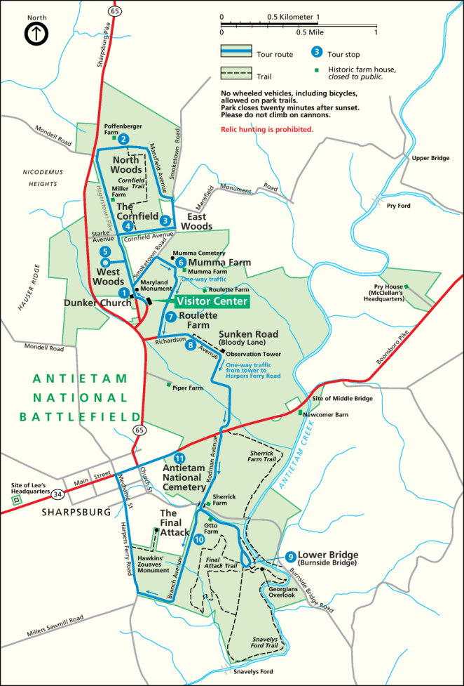
I’ll cycle around the battlefield roads and reflect on the sad chapter in our history that led to the preservation of this otherwise lovely place. After leaving the battlefield I’ll stop in Sharpsburg for lunch and to pick up a cold supper to eat at the campground.
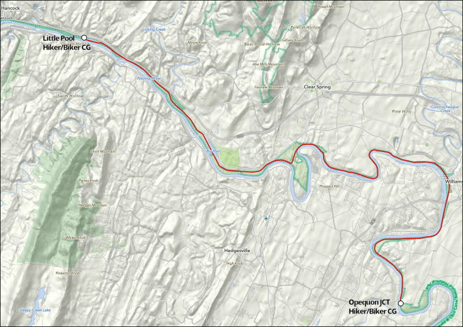
Day 5 – Monday, August 13, 2018
Opequon Junction Hiker/Biker Campground (Mile 92.7) to Little Pool Hiker/Biker Campground (Mile 122.2)
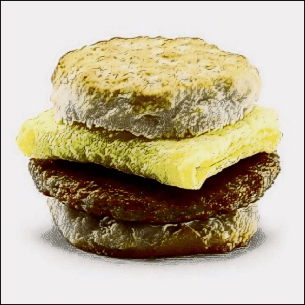
My first McDonald’s breakfast of the trip will likely happen today.
The restaurant is about a mile off route in Williamsport, Maryland. I should have a nice appetite worked up by the time I get there. I’ll look around the city, check out the Visitor Center, pick up a cold supper and other supplies at a grocery, and head back to the Towpath. The remainder of the day does not have any “big ticket” things to see. Rather, it’s just a nice ride through an area that, as I ride further into the western part of the state of Maryland, is becoming more mountainous, remote and thinly settled. There are no places to eat or stores along the Towpath for the rest of the day past Williamsport.
- Williamsport, Maryland/C&O Canal Visitor Center (Towpath Mile 99.4)
- Conococheague Aqueduct (Towpath Mile 99.5)
- Charles Mill Ruins (Towpath Mile 108.1)
- Four Locks area (Towpath Mile 108.6)
- Fort Frederick (Towpath Mile 112.1)
- Big Pool (Towpath Mile 112.5-114)
- Western Maryland RR Rail-Trail – east end access (Towpath Mile 114.5)
The ride is fairly short today: 29.5 miles/just slightly less than 50 kilometers. I am undecided as to whether I will stay on the Towpath or take the paved Western Maryland RR Rail-Trail that runs parallel to it just a few tens of yards/meters away. I guess it will depend on the condition that the Towpath surface has been in. We’ll see.
Day 6 – Tuesday, August 14, 2018
Little Pool Hiker/Biker Campground (Mile 122.2) to Stickpile Hill Hiker/Biker Campground (Mile 151.2)
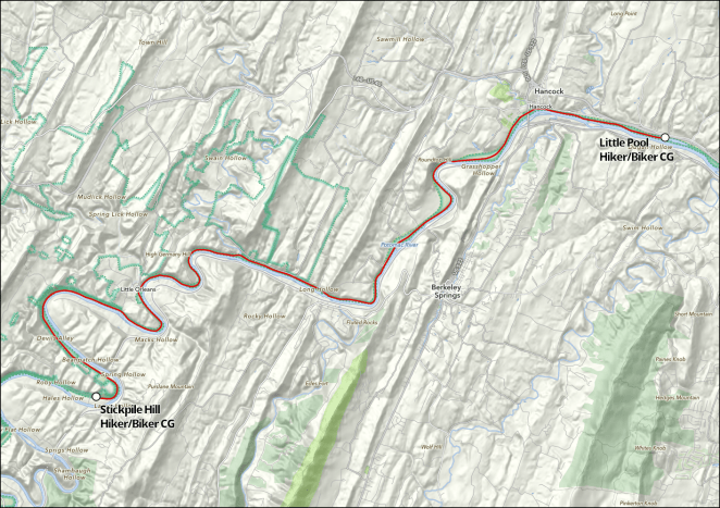
The sixth day of my ride is another just under 30 mile/50 kilometer day. Almost immediately after I start in the morning I will ride through Hancock, Maryland. There’s no McDonald’s here, but I should be able to find a nice local café. Once again I’ll stop to pick up cold food for supper, as there is nowhere else along the Towpath to stop for the rest of the day except for a bar: Bill’s Place, near the hamlet of Little Orleans.
- Hancock, Maryland (Towpath Mile 124.1)
- Western Maryland RR Rail-Trail – west end access (Towpath Mile 136.3)
- Little Orleans (Towpath Mile 140.8)
The Canal and Towpath have entered the central Appalachians today.
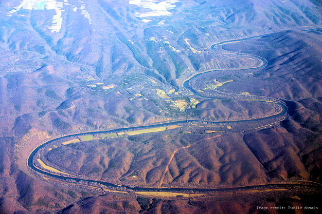
Potomac River bends around New Orleans, which is in the center of the image
The land is incredibly rugged on both sides of the Potomac, and the ability of the river to carve the narrow gap I will ride in is almost incomprehensible.
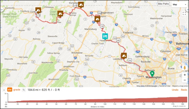
Day 7 – Wednesday, August 15, 2018
Stickpile Hill Hiker/Biker Campground (Mile 151.2) to Evitts Creek Hiker/Biker Campground (Mile 180.0)

The final day of my ride on the Towpath will have its challenges. Well, one challenge, actually, but it is a big one.

Paw Paw Tunnel, downstream portal
The Paw Paw Tunnel is expected to be closed, per the Park Service, starting August 1st [link] in order to allow continued stabilization of the cliffs that the Towpath runs next to as it approaches the downstream portal. As I will miss that date by about two weeks, this will require that I make a strenuous “over the mountain” detour, of which I will say more below.
The day’s cycling is the shortest of the full days on the Towpath at just under 29 miles. I’ll get lunch in Paw Paw, West Virginia at the convenience story there. Just after I pass the Forks of the Potomac- the Canal and Towpath follow the North Fork- I’ll make another foray into West Virginia, this time into the hamlet of Green Spring and will, as has become the custom, pick up some items for a cold supper. From there it will be a couple more hours to the outskirts of Cumberland, Maryland and Evitt’s Creek Hiker/Biker Campground.
- Paw Paw Tunnel – downstream entrance (Towpath Mile 155.2)
- Paw Paw Tunnel – upstream entrance (Towpath Mile 155.8)
- Paw Paw, West Virginia via MD State Highway 51 (Towpath Mile 155.2+1 mile off route)
- Town Creek Aqueduct (Towpath Mile 162.3)
- Forks of the Potomac (Towpath Mile 165.1)
- Old Town Lockhouse (Towpath Mile 166.7)
- Green Spring, West Virginia via toll bridge (Towpath Mile 168+0.5 miles off route)
The Paw Paw Tunnel detour is a big deal. Beyond missing the experience of cycling through this masterwork of 19th century civil engineering, I will have to walk my loaded bike up a dirt path that climbs an almost 400 or so foot/120 meter ridge which at some points exceeds a 15% grade and then walk it down the other comparably steep side.
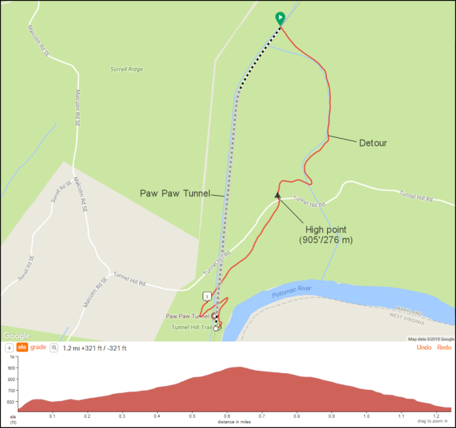
I’m figuring that this one and a quarter mile long death march will easily take a couple of hours. I am not looking forward to it.
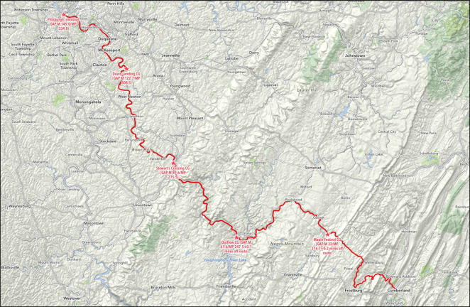
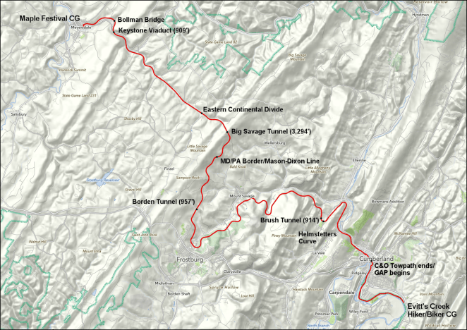
So on Wednesday, August 16th, I’ll get up, pack my gear on my bike, and ride the last four miles/six and a half kilometers of the Towpath. When I reach the middle of the city of Cumberland and the end of the C&O Canal, the Towpath will become the Great Allegheny Passage- the GAP, and I will be more than halfway from the start of my trip in Washington, D.C. to Pittsburgh, Pennsylvania. That segment of my ride will be coming up next- thanks for following along.


 Base image credit: Public domain
 Base image credit: Public domain
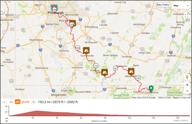

 Two weeks? Urrrrgh! Anyway, in the meantime
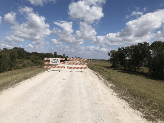


![To embiggen this, click here [link]](https://imageshack.com/a/img921/9826/XoRXyS.png)