 My trip from Washington, D.C. to Kansas City will start on the 184.5 mile/296.9 kilometer long C&O (Chesapeake & Ohio) Canal Towpath which runs along the abandoned C&O Canal on the north side of the Potomac River between the Georgetown District of D.C. and Cumberland. Maryland. The Towpath’s purpose when built is evident in its name- a path to allow the people and animals to pull with ropes the laden canal boats upstream against the modest current. It was probably pretty slow going.
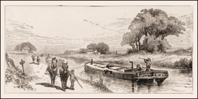
Briefly, as there are comprehensive sources about the C&O Canal and its towpath readily available on the web- a good place to start is the National Park Service site [link]– the canal was envisioned by, among others, George Washington in the late 1700s, as a way to commercially link the Middle Atlantic states and the Ohio Valley. Construction started on July 4, 1828 and the Canal was completed to the city of Cumberland 22 years later, never reaching the Ohio Valley. The reason for this is found in another ambitious transportation start-up that, in a twist stranger than fiction, broke ground the same day in 1828, the Baltimore & Ohio Railroad. By the time the Canal reached Cumberland the railroad was already there and in fact would reach the Ohio River at Wheeling, West Virginia two years later in 1852. The Canal was, essentially obsolete from that point on and plans to extend it further westward were abandoned. Amazingly it continued to operate until 1924, when it ceased operations altogether and maintenance was discontinued.
Ownership passed to the federal government in the Great Depression. For a long time nobody seemed to know what to do with the Towpath. There was a proposal to build a scenic parkway along its course, which would have been lovely but thank heavens nothing ever came of it. In the mid 1950s Supreme Court Justice William O. Douglas made a eight day hike on the Towpath in support of his argument that the Canal should be restored and preserved as a historical monument. In 1971 President Richard Nixon signed an act doing just that, entrusting the work and management to the National Park Service. Coming up on 50 years later and just a decade short of its 200th anniversary, the C&O Canal Towpath has been largely restored to the condition it was in during its prime.

Over the past 25 years the C&O Canal Towpath has become one of bicycle touring’s Holy Grails. While I could not immediately find statistics for through rides, anecdotally it would appear that several thousand riders do this one way or the other every year. Some even make it a round-trip!
The surface of the Towpath is mostly dirt and small gravel. Sometimes it looks like a one lane road with grass growing down the middle. Sometimes there are roots and larger stones to watch out for. In rainy periods it can become very muddy. It is my understanding that, while the Towpath surface is more challenging than riding on a conventional unpaved bike trail, it is reasonably rideable on a loaded touring bike so long as wider tires, such as my 700x38s, are used. We’ll see.
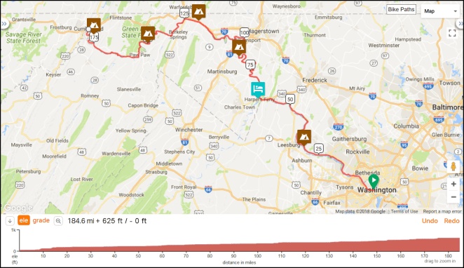
As noted, the official length of the Towpath is 184.5 miles/296.9 kilometers from end to end. In Cumberland it directly transitions into the Great Allegheny Passgae (GAP) Trail, which allows for a continuous off-road cycling route from D.C. to Pittsburgh, Pennsylvania. This is the route I will be following on this stretch of my ride. The Towpath climbs, depending on whose figure you go by, somewhere between 605 feet/184.4 meters and 625 feet/190.5 meters between D.C. and Cumberland, and there is no appreciable elevation loss along its length. For east to west cyclists the climbing is done every time a lock and dam on the canal is passed, which results in more than 70 short 8-10 foot/around three meter rises by the time the ride is complete. Between these short climbs the towpath is more or less, as one would expect, flat.
There are numerous opportunities for the bikepacking cyclist to camp along the Towpath. Along with several commercial or non-NPS public campgrounds there are frequent “Hiker/Biker” primitive campsites, which are free of charge- an amazing throwback to better times. These sites are first come-first served but my understanding is that no cyclist ever gets turned away from a Hiker/Biker location, as the people already there observe the etiquette of making room for a later arrival. I plan to stay at four Hiker/Biker sites, one other campground and a hostel- The Teahorse- in Harpers Ferry, West Virginia on my ride.
The area traversed by the C&O Canal Towpath on an east to west ride is first the foothills and then through the Appalachian Mountains proper. The Eastern Continental Divide is reached on the GAP 23.5 miles/37.8 kilometers past Cumberland. The Potomac River flows through this area in a steep-sided valley that often has just enough room on its floor for the river, the Canal and Towpath, and one or more ever-present still in use rail lines. The mountain ridges generally cross at a more or less perpendicular angle to the valley.

A couple of other great resources are the BikeWashington C&O Canal Towpath website [link] and the Great Allegheny Press’s “Trailguide” [link], which is now in its 14th edition and covers both the Towpath and the GAP Trail. Finally, for those of you who like to visualize using road maps, here’s an area map of Maryland and surrounding states with the route of the C&O Canal Towpath highlighted in blue.
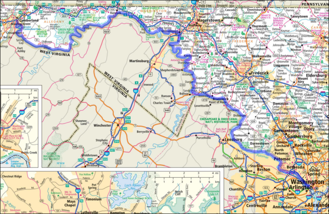
© 2018 RandMcNally, fair use asserted
Next up: My C&O Canal Towpath itinerary and some pre-ride observations.

Best of luck to you wish I could join you but to much going on here at this time.Be safe and have fun on your trip!
LikeLiked by 1 person