This second “road” segment of my Washington D.C. to Kansas City, Missouri ride is down the remainder of the Ohio River from the Cincinnati, Ohio area .
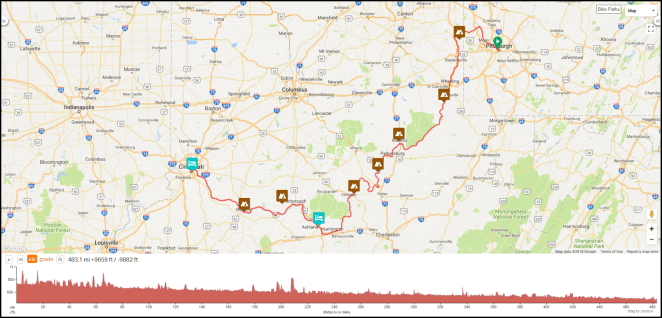
From the 21st to the end of the month of August I’ll be riding what I am calling the Ohio River East” segment. This part of the trip will see me cycling down one or the other bank of the Ohio, staying as close to the river as pavement will allow, This turned out to be the most difficult of the trip’s various segments to plan, as high-speed roads that are not particularly cyclist friendly have all but obliterated their two lane predecessors in several places in this narrow valley of the upper Ohio River. This situation is the main thing that will keep me switching from side to side of the river, which I will cross 11 times in the 483.1 mile/777.5 kilometer length of my route between Pittsburgh and Cincinnati. I’ll be at various times in four different states: Pennsylvania, Ohio, West Virginia and Kentucky.
The Ohio River is the largest tributary of the Mississippi River, and is the tenth longest river in the United States at 981 miles/1,578.8 kilometers. It drains an area of 204,000 square miles/529,000 square kilometers.

It has the third largest outflow at its mouth at Cairo, Illinois of the rivers in the U.S., 308,400 cubic feet/8,733 cubic meters of water per second, surpassed only by the Mississippi and St. Lawrence Rivers. It discharges over four times the amount of water into the Mississippi as does the Missouri, and at Cairo its flow exceeds the Mississippi’s. For a river that is so large, the Ohio has a remarkably short drop from its source in Pittsburgh to its mouth at Cairo: just 419 feet/127.7 meters. This is a little less than six inches per mile/around eight centimeters per kilometer. The river is navigable for its entire length due to a succession of 19 locks and dams operated by the United States Army Corps of Engineers. Because the drop along the entire river is so minimal the dams do not impound the rivers flow as lakes. Rather, the Ohio tends to look pretty much along its length exactly like what it is: a big river. The valley that it runs through for almost its entire length contributes to this as well. This valley is cut through the limestone that underlies much of the Midwestern U.S. and generally has a narrow floor with alluvial deposits creating narrow strips of land on one or both sides of the river and steep sides that often, especially in the valley above Cincinnati, take the form of rock cliffs. The sides of the valley are fairly uniform in height along upper three quarters of the river, reaching between 100 to 300 feet/30 to 90 meters above the water.
Along the way down the Ohio on this segment there will be ten overnight stays, not counting the one with a Warmshowers host in the Cincinnati area. I’ll stay in three state parks, three municipal campgrounds, and with a Warmshowers host in Ashland, Kentucky. I’ll also spend an overnight in Powhatan Point, Ohio, but as this is written I don’t know whether that will be in a municipal park with permission or with a local area host (the extremely kind Assistant to the Mayor offered to let me camp in her yard if the village council is not forthcoming with permission to stay in the park). Two days, the 18th and the 23rd, will be rest/slack days.
I’ll ride distances ranging from the longest at 65.5 miles/105.4 km between Maysville, Kentucky and Cincinnati and the shortest at 38.5 miles/62.0 km between Marietta, Ohio and Forked Run State Park. My average distance over the eight riding days will be just a bit more than 60 miles/97 kilometers each day. The terrain, like I said about my Mississippi River ride last fall [link], is downhill all the way (hey!- I’m riding down a river, remember?) except when its not. In Pittsburgh as I stand with my bike at the point of Triangle Park I’ll be just above 710 feet/216.4 meters above sea level and just south of Cairo when I reach Fort Defiance at the southernmost tip of Illinois I will be a little above 290 feet/83.4 meters in elevation. The elevation of the Ohio in Cincinnati is 455 feet/138.7 meters, about five-eighths of the river’s total drop.

The largest hill on the segment, around 500 feet/150 meters in elevation gain, is on the first day of the segment when I have to climb out of the river valley up to Tomlinson Run State Park. That will be a challenge after all the easy hill climbing days since the start of the ride, and it is likely the biggest climb I will make the entire trip. The rest of the hills over the course of the segment are nothing to write home about- the tallest are 250 to 300 footers/75 to 90 meters high. In rural areas, though, roads up them can be quite steep as grades can approach and sometimes exceed ten percent.
I’ll be populating the individual day’s itineraries with information on an ongoing basis over the next couple of weeks, so if you are reading this before August 21st you should come back by or before that date to see the itinerary in a complete form. This will allow me to get all the remaining itineraries up and then work on them at my leisure before I start riding the segment in a few weeks. Thanks, as always, for following along
Day 13 – Tuesday, August 21, 2018
Pittsburgh [notional] (Mile 334.8) to Tomlinson Run State Park Campground (Mile 390.7+3.7 miles off route)

59.6 miles/95.9 km. Ride with GPS route [link]. Last day in Pennsylvania, first day in Ohio
Day 14 – Wednesday, August 22, 2018
Rest/Slack Day at Tomlinson Run State Park Campground
Day 15 – Thursday, August 23, 2018
Tomlinson Run State Park Campground (Mile 392.9+3.4 miles off route) to Powhatan Point, Ohio [notional] (Mile 447.8)

58.3 miles/93.8 km. Ride with GPS route [link].
Day 16 – Friday, August 24, 2018
Powhatan Point, Ohio [notional] (Mile 447.8) to Washington County Campground (Mile 509.8+1.9 miles off route)
63.9 miles/102.8 km. Ride with GPS route [link].
Day 17 – Saturday, August 25, 2018
Washington County Campground (Mile 509.8+1.9 miles off route) to Forked Run State Park Campground (Mile 547.2+0.6 miles off route)
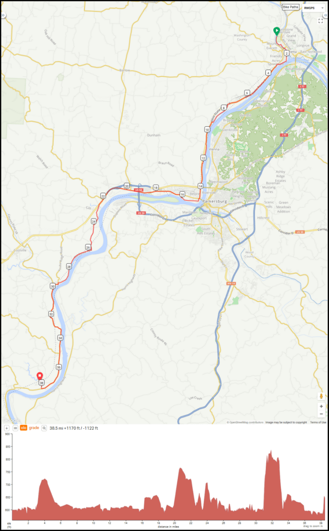
38.5 miles/62.0 km. Ride with GPS route [link].
Day 18 – Sunday, August 26, 2018
Forked Run State Park Campground (Mile 547.2+0.6 miles off route) to Krodel Park Campground (Mile 606.2+1.0 miles off route)

60.7 miles/97.7 km. Ride with GPS route [link].
Day 19 – Monday, August 27, 2018
Rest/Slack Day at Krodel Park Campground
Day 20 – Tuesday, August 28, 2018
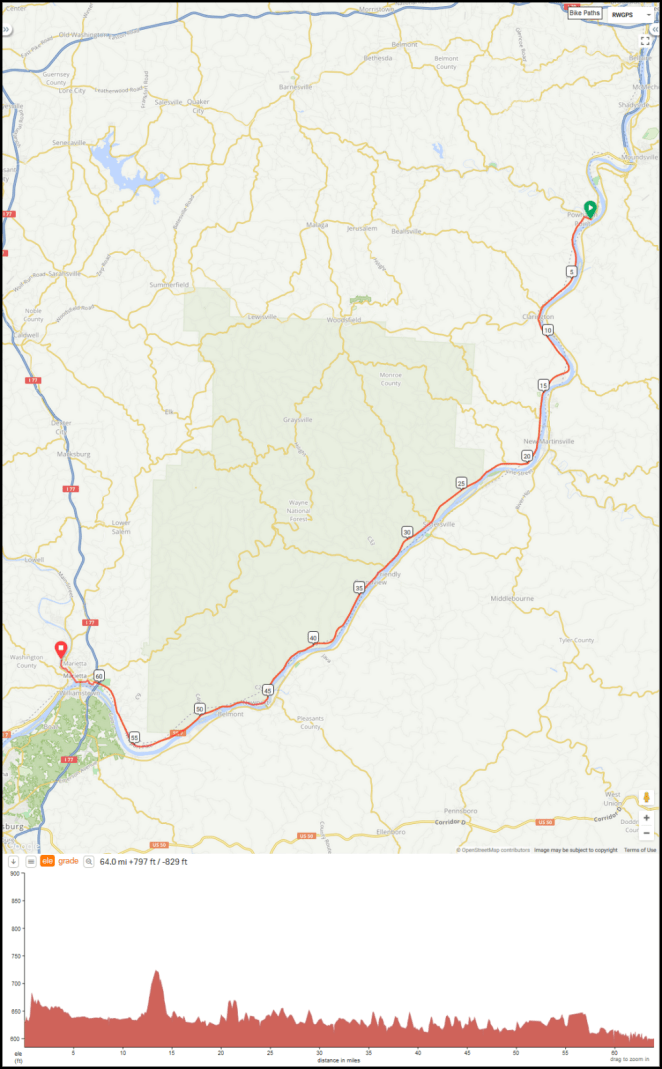
Krodel Park Campground (Mile 606.2+1.0 miles off route) to Ashland, Kentucky [notional] (Mile 668.9)

63.7 miles/102.5 km. Ride with GPS route [link]. Last day in West Virginia, first day in Kentucky.
Day 21 – Wednesday, August 29, 2018
Ashland, Kentucky [notional] (Mile 668.9) to Shawnee State Park Campground (Mile 708.4+5.2 miles off route)
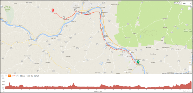
44.7 miles/71.9 km. Ride with GPS route [link].
Day 22 – Thursday, August 30, 2018
Shawnee State Park Campground (Mile 708.4+5.2 miles off route) to Maysville River Park Marina (Mile 753.2+2.4 miles off route)
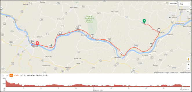
52.5 miles/84.5 km. Ride with GPS route [link].
Day 23 – Friday, August 31, 2018
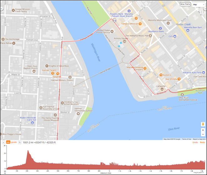
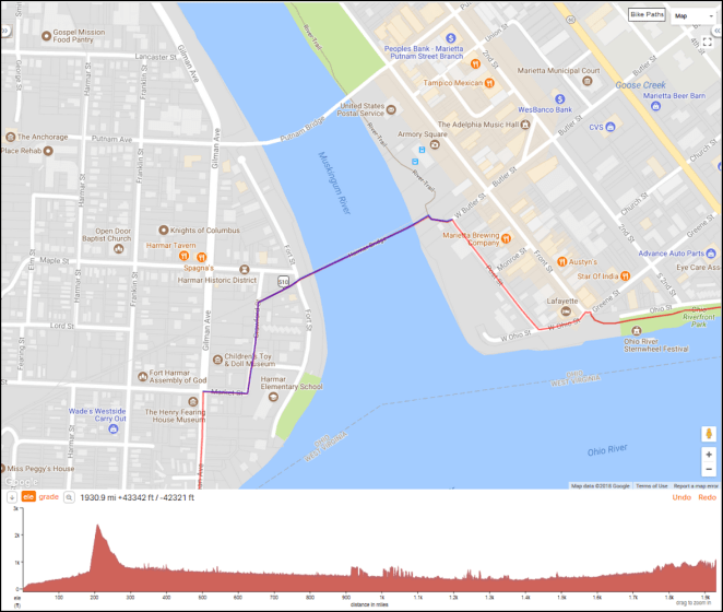
Maysville River Park Marina (Mile 753.2+2.4 miles off route) to Cincinnati, Ohio [notional] (Mile 816.3)

65.5 miles/105.4 km. Ride with GPS route [link].