 days to Lake Itasca!
 When I was in the army back during the bad old Vietnam-era days, they used to call folks who were just a few days from ending their service on their ETS date “Single Digit Midgets.” If that term still holds true today then Gary and I are getting very, very small. I’ll be flying to Minnesota from Anchorage a week from today and Gary is already on the road driving there. So this is definitely happening, and soon.
I have noted in connection with last year’s ride down the Atlantic coast that I do the route planning for these long trips on a web-based program called RidewithGPS [link]. There’s a free version and two-tiered paid version- for most cyclists I think the free version would work just fine- it’s what I used for several years before subscribing to the “Premium” tier of the paid version. Here’s a comparison chart.
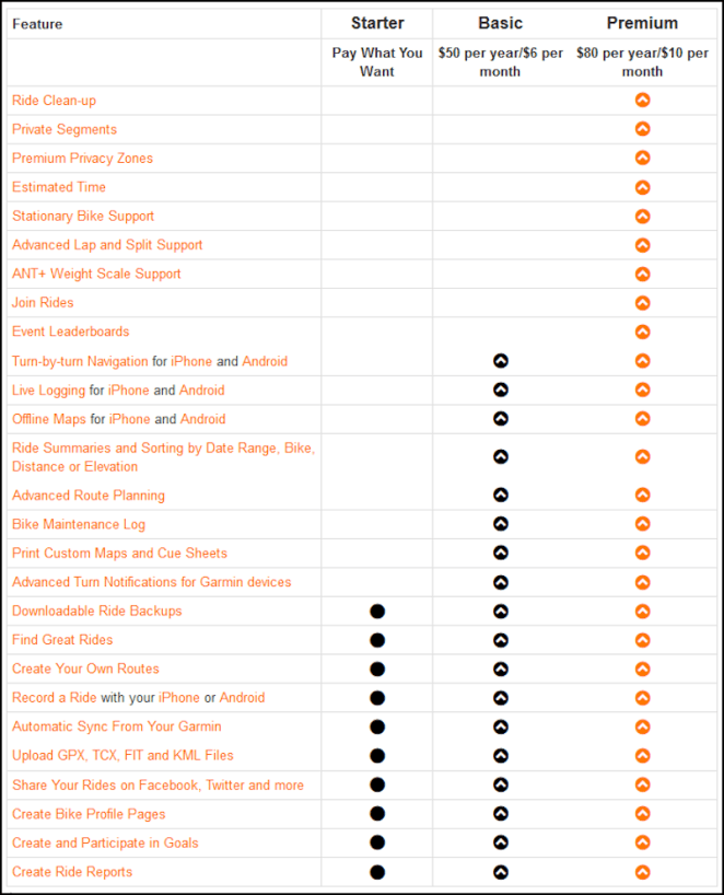
A couple of years ago I planned a “Southern Tier” transcontinental ride with the free version. It was fully detailed and I still refer to it when answering questions from other riders. What the premium version gets me that I find worthwhile are the advanced route planning tools, the turn by turn notification and downloadable maps for the iPhone app and for ride clean-up. I also get the satisfaction of supporting a company that I find to be really proactive and user-friendly. The program and accompanying app have been frequently updated to add or refine features. I have talked with a real person at tech support twice to help with issues I’ve had twice and each time it was clear to me that the assistance I was given was complete and comprehensive. My guess is that everyone at the Portland, Oregon-based developer rides bikes to work.
Strava [link] is similar, and I have it installed on both my PC and my iPhone. I find it less richly detailed and really prefer working with Ride with GPS. The only advantage to Strava, IMHO, is that rides, once completed, automatically upload to Relive [link] which emails you a couple of hours later a flyover animation of the ride. Very, very cool.
So I’ve been working on my Mississippi River b2b route for about six months. Most of it was in place by April of this year, but I’ve worked mile-by-mile to refine it since then. I’ve located every shoreline bike path I can find, every paved minor road that runs closer to the river than the easily spotted route and the best low traffic streets through busy neighborhoods. I annotated the route with nearby points of interest, bike shops, pharmacies, Target stores, lodging and campground location, mileage data, and other helpful information.

And, as soon as I hit the save button all this info is available on my iPhone.
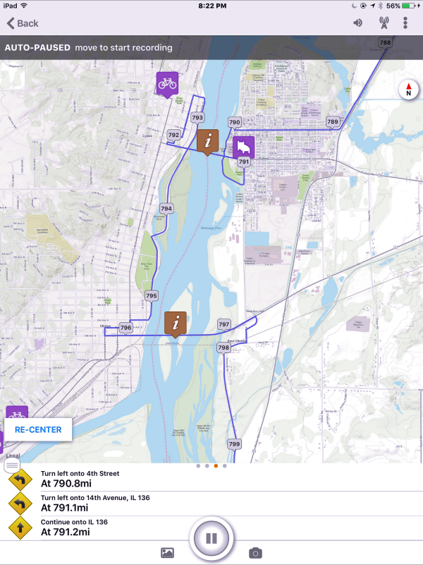
Here is the link to the current Ride with GPS b2b route. It is a work in process and likely will be replaced by an updated version two or three more times before we take off from Lake Itasca on the 26th.
I’ll keep you posted.
David
 I will be flying to Minneapolis in the morning, so it’s one last crazy busy day. In a few minutes I’ll run over to pick up some matched luggage
 to pack my panniers, gear and helmet in. Catch up with you later.
 days to Itasca!
 days to go!
 days until the start!
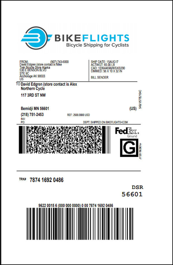
 days left to go!!
 days left!
 days left.
 days to go!
