 This second “road” segment of my Washington D.C. to Kansas City, Missouri ride is down the remainder of the Ohio River from the Cincinnati, Ohio area to just below Cairo, Illinois, 558 miles/898 kilometers away.

I’m calling the segment “Ohio River West,” and you can find the route on Ride with GPS by clicking here [link]. On it, I will continue to cycle down one or the other bank of the river, still staying as close to the river as pavement will allow. This turned out to be a little bit more difficult goal to achieve than it was for the Ohio River East segment, as I found in several places that many roads along the river, which twists and winds in frequent sinuous turns as the Ohio approaches Cairo and the Mississippi, have often either reverted to gravel tracks or simply vanished altogether in this predominately rural and fairly isolated area.

In search of adequate roads that are the closest to the river I will cross it 12 times in the course of the segment. Three of those times will be by ferry- once just west of Cincinnati on the Anderson Ferry and then twice- a “there and back” on the ferry from Kentucky to Cave-in-Rock, Illinois. Sadly, these are the only two ferries remaining along the segment out of the dozen or so that were in operation 50 years ago. I’ll once again spend time on the segment in four different states: Ohio, Kentucky, Indiana and Illinois.
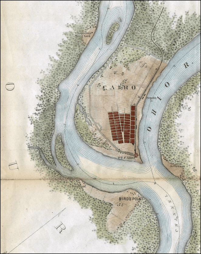
Over the course of the segment the Ohio River will drop from its 455 foot/138.7 meter elevation above sea level at the Cincinnati riverfront the remaining 165 feet/50.2 meters to its mouth at Cairo, where it empties into the Mississippi River 290 feet/138.7 meters above the Gulf of Mexico, which is still just short of 1,000 river miles/1,600 kilometers away.
Along this segment’s route there will be thirteen overnight stays and I will ride a portion of a fourteenth day from near the hamlet of New Grand Chain, Illinois to the Ohio River’s mouth at Fort Defiance, then continue back north along the Mississippi River towards St. Louis, Missouri. I’ll stay in three state parks, one municipal campground, three private campgrounds, and with Warmshowers hosts in Henderson and Paducah, Kentucky. There are two overnights that are notionally set in the tiny towns of Stephensport, Kentucky and Rockport, Indiana. When I arrive at those locations I plan to ask for permission to stay in a local park or other property in the community. Failing that, I will be wild camping in those areas. Two days, September 3rd and 11th, will be rest/slack days.
I’ll ride distances ranging from the longest at 63.2 miles/101.7 kilometers between New Grand Chain Lodge & Campground and Thebes Landing Campground (note, though, that only 31.2 miles/50.2 kilometers of that is in the segment; the remainder is part of the Cairo, Illinois to St. Louis, Missouri segment) and the shortest at 29.9 miles/48.1 km between Paducah, Kentucky and New Grand Chain Lodge & Campground. My average distance over the twelve riding days will be fairly short for a “road” segment: 46.5 miles/74.8 kilometers each day. The terrain remains, like the Ohio River East segment, downhill all the way except, again, when its not. The largest hill is mostly off-route: a 350 foot/105 meter climb out of the river valley on Day 28 up to South Harrison Park Campground. There are also some strenuous hill climbs on Day 33 on the Kentucky side of the river between Old Shawneetown and Cave-in-Rock, Illinois.
As with the Ohio River East segment, I’ll be populating each individual day’s itineraries with information on an ongoing basis over the next couple of weeks, so if you are reading this before September 1st you should come back by or before that date to see the itinerary in a complete form. This will allow me to get all the remaining itineraries up and then work on them at my leisure before I start riding the segment in September. Thanks, as always, for following along
Day 24 – Saturday, September 1, 2018
Cincinnati, Ohio [notional] (Mile 816.3) to Campshore Campground (Mile 857.5+0.4 miles off route)

41.4 miles/66.6 km. Ride with GPS route [link].
Day 25 – Sunday, September 2, 2018
Campshore Campground (Mile 857.5+0.4 miles off route) to Clifty Falls State Park Campground (Mile 913.2)

56.2 miles/90.5 km. Ride with GPS route [link].
Day 26 – Monday, September 3, 2018
Rest/Slack Day at Clifty Falls State Park Campground
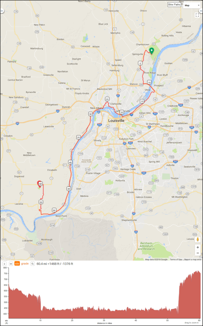
Day 27 – Tuesday, September 4, 2018
Clifty Falls State Park Campground (Mile 913.2) to Charlestown State Park Campground (Mile 951.2+1.8 miles off route)
39.7 miles/63.9 km. Ride with GPS route [link].
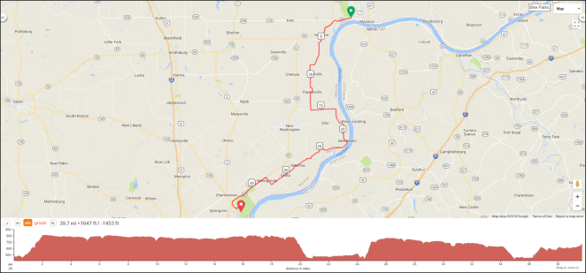
Day 28 – Wednesday, September 5, 2018
Charlestown State Park Campground (Mile 951.2+1.8 miles off route) to South Harrison City Park Campground (Mile 1,003.5+6.6 miles off route)
60.4 miles/97.2 km. Ride with GPS route [link].
Day 29 – Thursday, September 6, 2018
South Harrison City Park Campground (Mile 1,004.6+5.8 miles off route) to Stephensport [notional] (Mile 1,057.7)
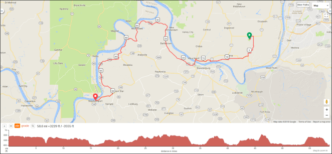
58.6 miles/94.3 km. Ride with GPS route [link].
Day 30 – Friday, September 7, 2018
Stephensport, Kentucky [notional] (Mile 1,057.7) to Rockport, Indiana [notional] (Mile 1,112.2)

54.7 miles/88.0 km. Ride with GPS route [link].
Day 31 – Saturday, September 8, 2018
Rockport, Indiana [notional] (Mile 1,112.2) to Henderson, Kentucky [notional] (Mile 1,159.4)
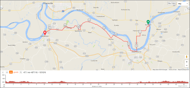
47.1 miles/75.8 km. Ride with GPS route [link].
Day 32 – Sunday, September 9, 2018
Henderson, Kentucky [notional] (Mile 1,159.4) to Fiedlerville RV Park & Campground (Mile 1,214.4+1.6 miles off route)
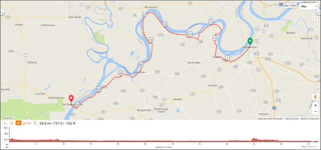
56.8 miles/91.4 km. Ride with GPS route [link].
Day 33 – Monday, September 10, 2018
Fiedlerville RV Park & Campground (Mile 1,214.4+1.6 miles off route) to Cave-in-Rock State Park Campground (Mile 1,254.3+0.3 miles off route)
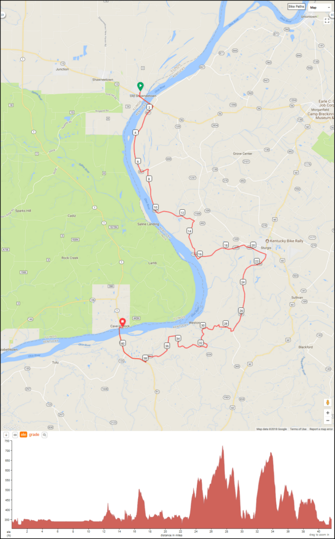
41.7 miles/67.1 km. Ride with GPS route [link].
Day 34 – Tuesday, September 11, 2018
Rest/Slack Day at Cave-in-Rock State Park Campground
Day 35 – Wednesday, September 12, 2018
Cave-in-Rock State Park Campground (Mile 1,254.3+0.3 miles off route) to Paducah, Kentucky [notional] (Mile 1,314.6)

60.5 miles/97.4 km. Ride with GPS route [link].
Day 36 – Thursday, September 13, 2018
Paducah, Kentucky [notional] (Mile 1,314.6) to New Grand Chain Lodge & Campground (Mile 1,343.9+0.5 miles off route)
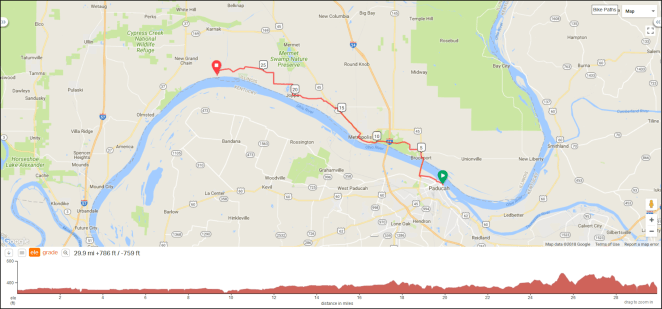
29.9 miles/48.1 km. Ride with GPS route [link].
Day 37 – Friday, September 14, 2018
New Grand Chain Lodge & Campground (Mile 1,343.9+0.5 miles off route) to Thebes Landing Campground (Mile 1,406.3)

63.2 miles/101.7 km. Ride with GPS route [link].
